16 Days China-Thailand Mekong River Cruise Tour by Speed Boat
The Mekong River brings together the best of old and new Indochina from stilt villages to mountain temples. The Upper Mekong starts from the plateau of Tibet before winding its way through China and Laos along its border with Myanmar and Thailand until it reaches Cambodia. There it crosses Khone Falls, the largest waterfall in Southeast Asia, which prevents the Mekong from being fully navigable from sea to source. From these falls, the lower section of the river flattens out considerably and is susceptible to serious seasonal swelling.
Highlights:
- Enjoy vast swathes of untouched nature.
- Gain a deeper understanding of the complex history in this region and be charmed by the friendly locals as they go about their lives along this magnificent waterway.
Brief Itinerary
- Day1 – Arrive in Kunming
- Day2 – Kunming
- Day3 – Kunming – Shangri-la
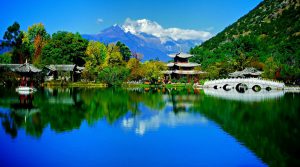
- Day4 – Shangri-la – Lijiang
- Day5 – Lijiang
- Day6 – Lijiang-Dali
- Day7 – Dali – Jinghong
- Day8 – Jinghong City
- Day9 – Jinghong – Chiang Saen by speed boat
- Day10 – Chiang Saen – Chiang Rai
- Day11 – Chiang Rai-Chiang Mai
- Day12 – Chiang Mai
- Day13 – Chiang Mai – Bangkok
- Day14 – Bangkok
- Day15 – Bangkok
- Day16 – Departure from Bangkok
Detailed Itinerary
Day1 – Arrive in Kunming
Activities: the Green Lake,Kunming City
Meals: Breakfast
Hotels: Kunming
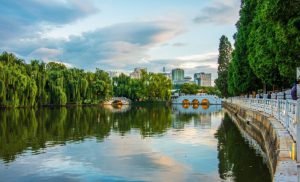
–The Green Lake:
Green Lake Park or Cui Hu Park is an urban park in Kunming. During the winter months, black-headed gulls from Siberia migrate to Green Lake and entertain the crowds of visitors as they circle around and snap up bread, usefully provided by a herd of local vendors, thrown up into the air by tourists. There are performances of Chinese operas. This lovable scene, in which man, birds, and nature mingle in such harmony, has kept occurring over the last ten years.
–Kunming City:
Kunming, capital of Yunnan Province, is known as ‘the City of Eternal Spring’ for its pleasant climate and flowers blooming all year long. With a history of more than 2,400 years, Kunming was the gateway to the celebrated Silk Road that facilitated trade with Tibet, Sichuan, Myanmar and India. Today it is the political, economical and cultural center of Yunnan as well as the most popular tourist destination in southwest China.
Day2 – Kunming
Activities: the Stone Forest National Geo-park,Yuantong Temple,the Flowers and Birds Market
Meals: Breakfast
Hotels: Kunming
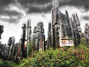
— The Stone Forest:
The Stone Forest is in Shilin Yi Nationality Autonomous County, which is about 85 kilometers from Kunming. It covers an area of 400 square kilometers (96,000 acres) and includes both large and small stone forests, as well as many other scenic spots. An old local saying says that ‘If you have visited Kunming without seeing the Stone Forest, you have wasted your time.’ Truly, the Stone Forest is one of the most important attractions of Yunnan.
— The Flowers and Birds Market:
Famous for its year-round mild climate, Kunming is often called Spring City. The famous Flowers and Birds Market in Jingxing Street is the city’s biggest, most attractive shopping market where spring reigns all year. Since 1983 the Flowers and Birds Market has gradually been built into a comprehensive public spot for leisure, shopping, and trading. Strolling on the market street, you can see shops and stalls of all sorts, especially those featuring flowers, birds, and fish.
–Yuantong Temple:
Yuantong Temple is at the foot of Yuantong Hill in the northern part of Kunming. With a history of more than 1,200 years, Yuantong Temple is the grandest as well as the most important Buddhist temple in Yunnan Province. Unlike all other Buddhist temples, which are built on an ascendant, you enter Yuantong Temple from above and descend along a gently sloping garden path. The view before you starting your peaceful walk beneath the gigantic cypress trees that line the garden path to the temple with its extensive array of flowers and foliage is deeply restful and impressive. A delicate stone bridge which has an elegant octagonal pavilion stands in the center connects Mahavira Hall and the temple entrance. The pavilion is connected to the rest of the complex by various bridges and walkways.
Day3 – Kunming – Shangri-la
Activities: Songzanlin Monastery, Dukezong Ancient Town, the Giant Prayer Wheel, Napahai Lake, Tibetan Village and Home-made
Meals: Breakfast
Hotels: Shangri-la
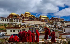
–Songzanlin Monastery:
Built in the style of Potala Palace in Lhasa, Tibet, the magnificent monastery complex resides on top of a hill and consists of the two Zhacang and Jikang lamaseries – which take on the form of five-story Tibetan watchtowers – five gates, numerous sub-lamaseries and hundreds of rooms for the monks. Walking up the 146 steps that lead to the main prayer hall is a tiring exercise at 3,300 meters above sea level, but it allows you to trace mentally the pilgrimage route that generations of devout Buddhists living on the plateau take on their knees and foreheads every year.
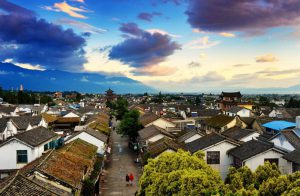
–Dukezong Ancient Town:
Dukezong, a Tibetan town in Shangrila, offers sanctuary to all those seeking refuge from the cares of city life. Dukezong’s authentic Tibetan dwellings, gilded prayer halls and pagodas, and lanterns of various shapes lighting the way along narrow, winding lanes are permeated with the grace and mystique of antiquity that enchants visitors the moment they set foot in it. Dukezong was a key stop on the Ancient Tea-Horse Trail and a focal point for Han-Tibetan exchanges. Despite its age, Dukezong is the largest and best-preserved Tibetan city among China’s 147 Tibetan counties. It is also site of the largest ancient Tibetan community.
–the Giant Prayer Wheel:
In Shangri-la,local residents and tourists turn a huge prayer wheel in Dukezong ancient city of Shangri-la County, southwest China’s Yunnan Province, March 12, 2010. The 21-meter-tall, 60-ton prayer wheel has attracted lots of people to visit. An eye-catching 24-meter (80-foot) tall golden prayer wheel sits on a hill. Though it was built recently for the sake of tourism, it has become an authentic item because local Buddhists now climb the hill to spin it to submit their prayers. You can twirl it, too, but do it only clockwise, as religious tradition dictates.
–Napahai Lake:
Napahai Lake (Napa Hai) is 3270 meters above sea level and covers 660 square kilometers. The lake fills up a valley surrounded on three sides by mountains which are covered in snow during winter and spring time. During the rainy season, the lake expands and the water will rush through the nine holes and empty into the Jinsha River. During the dry season, the water recedes and grassland appears. In autumn, the prairie changes into a golden color and flocks of yaks, horses, sheep graze there. Rare birds such as black necked crane, bar-headed goose and mallard flock to the area for winter.
Day4 – Shangri-la – Lijiang
Activities: Tiger Leaping Gorge (the upper part), the first Bend of Yangtze River, Shigu Ancient Town, Iron Chain Bridge, Lijiang Ancient Town
Meals: Breakfast
Hotels: Lijiang
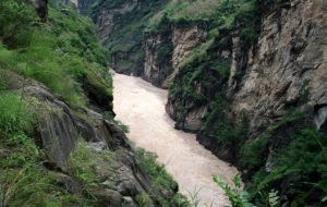
–Tiger Leaping Gorge:
Tiger Leaping Gorge (Hutiao Gorge) is on the Jinsha River of the upper reaches of the Yangtze) is located 105 kilometers south of Zhongdian County. The gorge is 17 kilometers long with a drop of 213 meters. The gorge is divided into three sections: Upper, Middle and Lower Hutiao. At the narrowest spot the river is only 30 meters wide. The mouth of the gorge is 1,800 meters above sea level. The river is flanked by Yulong and Haba snow mountains, with a height difference of 3,900 meters. It is one of the deepest gorges in the world.
–The first Bend of Yangtze River:
The First Bend of the Yangtze River is located about 70 km away from lijiang. The upper reaches of the Yangtze River is named the Jinsha River, which originates from the Qinghai-Tibet Plateau. The Jinsha River flowed southward along the Hengduan Mountain ranges and was forced to the turn to north because of the Alpine movements which caused changes in the earth’s physiognomy. When the river reaches Shigu Township, it makes an abrupt turn and flows further northward, forming the rare V-shape bend.
–Shigu Ancient Town:
Shigu town is 50 kilometers from Lijiang. It was named after a stone tablet in the shape of a drum.Shigu in Chinese is Stone Drum. Jinshajiang River flows at great speed down to Shigu Town and then with the width of the river enlarged from here, the speed of the water gradually comes down and makes Shigu Town a natural ferry Shigu Town is always an important part of the Tea-horse Road. From this place people can go south to Dali and north to Tibet. In the history, Zhuge Liang and Kublai Khan all close here to cross the Yangze River.
–Iron Chain Bridge:
There is a famous iron chain bridge spanning across the Chongjiang River that flows along from the left side of Stone Drum Town. The bridge is also named Tiehong Bridge because it resembles the shape of a rainbow arching over the waves below. The iron chain bridge was built during the Qing Dynasty with wooden boards held onto the iron chains on the bottom as the flooring and on the both sides as fence to protect the walkers. 17 meters in length, people would be feeling a bit wiggling while on it, but it does send them back to the snapshots of history.
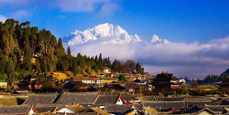
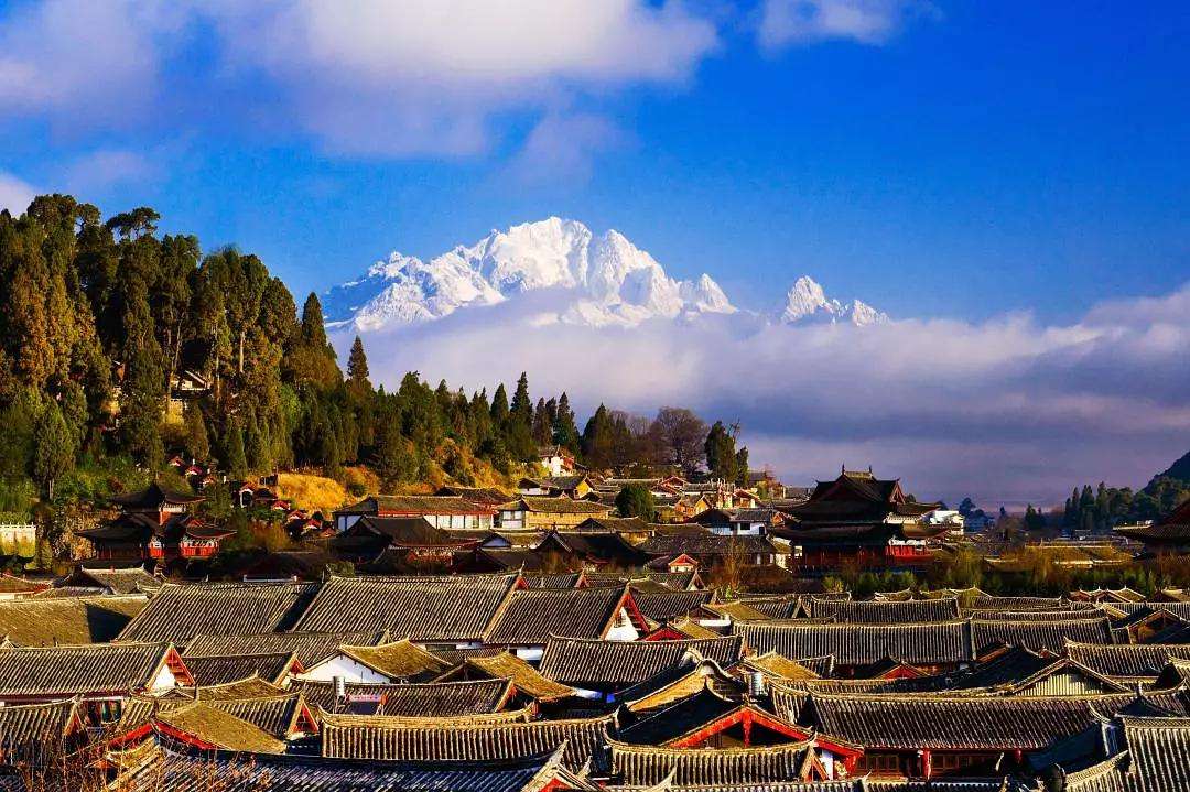
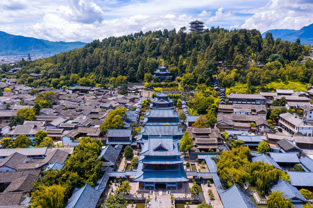
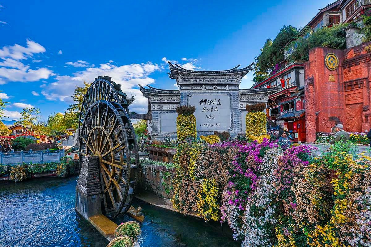
–Lijiang Ancient Town:
Someone said that Ljiang is the only fairyland which was left by God on the earth. Lijiang is an important city in ancient China, with numerous minorities. It is a well-preserved ancient town with 12 minorities, among which Naxi Nationality takes the major part of the whole population. As early as in Nanchao Dynasty, that is about 1600 years ago, the first residents moved here and the history of Lijiang Ancient Town began. Before 1996, Lijiang Ancient Town was an intact land from cultures of Han Nationality. However, with the speed up of modern civilization and tourism industry, Lijiang Ancient Town is influenced by modern features. At present, some Naxi people n longer wear their traditional clothing, and the children of Lijiang are educated in mandarin. You can even see the local residents talking with foreign travelers in fluent English, and the phenomenon is the consequences of commercial driving.
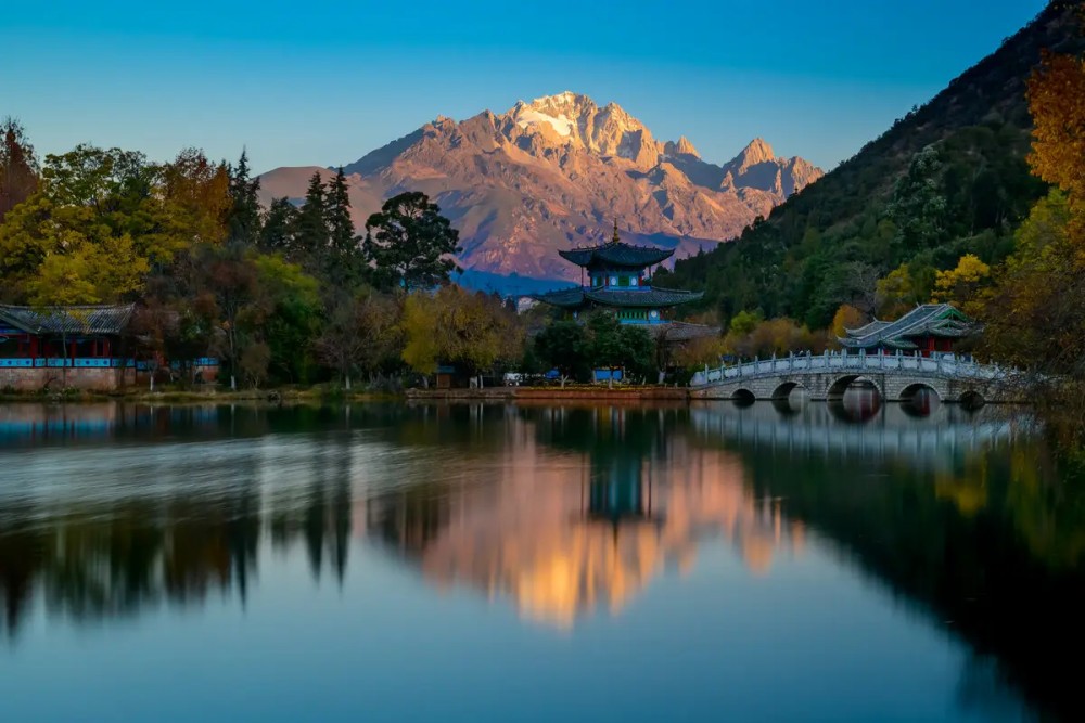
Day5 – Lijiang
Activities: Lijiang Ancient Town, Black Dragon Pool, Dongba Culture Museum, Yuhu Village and Joseph Rock’s Exhibition, Naxi Ancient Orchestral Music
Meals: Breakfast
Hotels: Lijiang
–Black Dragon Pool:
Black Dragon Pool (also Heilongtan), or Jade Spring (Yuquan) Park is the main headwater of the Yushui River which goes through the Old Town. It is just like the bright eyes of the town, shining with the wisdom. People believe that the gods of the Naxi people are living in the chestnut woods, beside the mouth of springs, behind the carved doors and below the bridges. The springs come from the god-protected mountains and gather in this place and finally form the dragon pool. Then water goes down a waterfall and becomes the Yuhe River, pouring life to the Old Town.
–Dongba Culture Museum:
Dongba Culture Museum is a museum in Lijiang City, Yunnan, China which deals with the of the Dongba culture of the Naxi (Nakhi) people.The Naxi is a minority with a long history and a brilliant culture. The Dongba culture is a most inclusive term referring mainly to the language and scriptures. The Dongba language is actually composed of 1,400 picture-like characters and symbols that are still used by Dongbas, researchers and artists of the culture. It is by now the only living hieroglyph in the world and is regarded as a precious cultural relic of mankind. On August 30, 2003, the Dongba classical literature was accepted as a written world heritage by UNESCO.
–Yuhu Village and Joseph Rock’s Exhibition:
Located about 15 kilometers North of Lijiang Old Town, the Yuhu village, belonging to the Naxi minority, is the last village of the valley; and is situated at the foot of the Jade Dragon Mountain in Lijiang. The houses, built with unique rocks called “monkey head”, sort of mix of the rocks and dried earth, makes the village looks the same as it was in the beginning of the 20th century when Joseph Rock chose this place as his residence place. Joseph Rock, an Austria-American botanist and explorer, lived in Yuhu village and other places in that region from 1922 to 1949. He was also a naturalist and Photographer, and the first foreign scholar to introduce Lijiang ethnic culture to the western world.
–Naxi Ancient Orchestral Music:
A crystallization of Taoist rite, Confucian ceremony, and the literary lyrics, poetic topics and musical tones of the Tang, Song and Yuan Dynasties, Naxi Ancient Music has developed its own unique style and traits – the result of 500 hundred years of evolution. It originally included three parts -‘Baisha Fine Music’ (Baisha Xiyue), ‘Dongjing Music’ (Dongjing Yinyue), and ‘Huangjing Music’ (Huangjing Yinyue), the last of which has long been lost in the river of time. Played on venerable Chinese musical instruments such as flute, shawm, Chinese lute, plectrum, and zither, Naxi Music has the power to cleanse the heart and relax the mind.
Day6 – Lijiang-Dali
Activities: Small boat cruise in Erhai Lake, Xizhou Ancient Town with Bai ethnic architecture, Zhoucheng Village with Bai ethnic Tie-dye Cloth Workshop, Three Pagodas of Chongsheng Monastery
Meals: Breakfast
Hotels: Dali
Erhai Lake is named after its shape and expanse. “Er” in Chinese means a human ear and “Hai” means a sea, hence its name Erhai. It is one of the seven biggest fresh water lakes in China and the largest highland lake next to Dianchi Lake (in Kunming). So it was called “Plateau Pearl”. The dimension is 41.5 km. by 6.9 km. It starts from Jiangwei of Eryuan County in the north and ends at Xiaguan in the south. The total storage capacity is 3 billion cubic meters and its elevation 1,972 meters.
–Xizhou Ancient Town:
About 18 km north of Dali old town, Xizhou is the typical town with Bai’s characters. More than 1500 years ago, Xizhou and nearby area has been the major habitat for the Bai people. Xizhou was once a commercial center of Yunnan, and the birthplace of Bai’s modern entrepreneurs. It is said that more than 140 wealthy families built their houses here, including the Yan’s, the Yang’s, the Dong’s and the Zhao’s. All these houses are decorated with woodcarvings, colored patterns, marbles and wash drawings, which represents the masterpieces of Bai’s architecture.
–Zhoucheng Village:
Zhoucheng Town is the biggest town of Bai people in Dali. More than 1,500 Bai families live in their houses which are located all together there in Zhoucheng Town. Zhoucheng Town you can see typical houses of Bai people with closed courtyards, consisting of three rooms and a “shining wall.” The purpose of the “shining wall” is to reflect light into the houses. Another configuration consists of four rows of houses and five dooryards.
–Bai ethnic Tie-dye Cloth Workshop:
Tie-dyeing originated from the central plains area in ancient China over 1,000 years ago. Being one of the locations of this craftsmanship, Zhoucheng Village near Butterfly Spring in Dali Old City is famous as the “Hometown of Bai People’s Tie-dyeing Art”. The tie-dyeing products in Zhoucheng Village are well sought after, both at home and abroad. Do drop by and witness for yourself the process of this historical craftsmanship. Who knows, you will return home with some cheap and beautiful crafted cloths.
— Three Pagodas of Chongsheng Monastery
Between Cangshan Mountain and Erhai Lake, the Three Pagodas stand like the legs of a huge tripod. Qianxun Pagoda, the main one, is square-shaped with closed eaves similar to Xiaoyan Pagoda in Xi’an. It has 16 tiers with a total height of 69.13 meters, and is in a typical architectural style of the Tang Dynasty. It was first built in the era of Fengyou Emperor of Nanzhao Kingdoms about the same time of the Tang Dynasty. On the south and north sides of the main pagoda stand two smaller ones of octagonal shape with dosed eaves. Each one has 10 tiers with a height of 43 meters.
Day7 – Dali – Jinghong
Activities: Dali Ancient Town, Dali Ancient City Wall, Foreigner Street,Jinghong City
Meals: Breakfast
Hotels: Jinghong
–Dali Ancient Town:
Located in Yunnan Province, Dali Ancient City is located 13 kilometers (about 8 miles) away from Dali City. The city’s history can be traced back to the early Ming Dynasty (1368-1644). Dali Ancient City was traditionally settled by the Bai and Yi ethnic minority groups and is the capital of the Dali Bai Autonomous Prefecture. The city is a beautiful example of an ancient Chinese city and has remained relatively untouched. Beautifully located on a fertile plateau nestled between the Cangshan Mountains to the west, and Erhai Lake to the east, the ancient city has been attracting visitors for centuries.
–Dali Ancient City Wall:
The Ancient City Wall of Dali was built in the 15th year of Hongwu in the Ming dynasty (AD1382) after the Ming army occupied Dali. Backing on the Mt. Cangshan and facing the Erhai, it is 7.5 meters high and 6 meters deep rounding an area of 36 square kilometers. Nowadays, only some parts of the north and south ancient wall were still standing. The Ancient City Wall of Dali is a well-known brand of Dali. As a tourist attraction, it is already given much publicity to among the general people around the country and abroad.
–Foreigner Street:
The Foreigner Street is originally named Huguo Road. Paved by stone tablets, the street extends from east to west, 1,000 meters long and 7 meters wide. There are many Chinese and western food shops, jewelry stores, antique shops, galleries and tie-dyeing shops there.
–Jinghong City:
Jinghong City is located in the middle of Xishuangbanna Dai Minority People’s Autonomous Prefecture, borders on Myanmar, is the political, economic, cultural and traffic center of Xishuangbanna, has an area of 7133 square kilometers and population of 350 thousand. The nationalities living in Jinghong include Han, Dai, Hani, Jinuo, Lahu, Bulang, Yi and Yao. Lunan Shan Mountain has an elevation of 2196 meters, is the highest point in Jinghong, the lowest point is where the Mekong flows out of China; altitude there is only 485 meters.
Day8 – Jinghong City
Activities: Menglun Tropical Botanical Garden, Dai Ethnic Garden, Manting Park
Meals: Breakfast
Hotels: Jinghong City
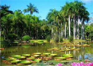
Xishuangbanna Tropical Botanical Garden of the Chinese Academy of Sciences is situated in Xishuangbanna Dai Autonomous Prefecture. The site is a gourd-shaped peninsula almost totally surrounded by the Luosuo River, a branch of the Mekong River. Still having large areas covered with tropical rain forest, it is an ideal place for studying tropical plants. Since its establishment in 1959 under the leadership of the well-known botanist Prof. Tsai Hsetao, the Botanical Garden has been engaged in scientific research, germplasm preservation, public education and scientific exploitation, and has developed its typical tropical landscape and colourful ethnic features.
–Dai Ethnic Garden:
Called as “the First Eco Village”, Xishuangbanna Dai Minority Park is located in Menghan Town, neighboring Lancang River and Longde Lake. It is an ecotourism zone integrated with natural scenery and Dai culture. Every body must go to the temple for divine blessing. Then until Opening the Door festival, couples could not hang out together; get married or go out. Mid October is Opening the Door Festival. The rainy season is over; couples could court one another and get married. There will be huge gathering at that day. It is also the harvest day. Water Splashing Festival is a traditional festival of Dai nationality. It is on the new year of Dai Calendar. People will water the Buddha in the temple and pour water to one another to show their sincere blessing and wash away their troubles.
–Manting Park:
Manting Park, situated in the southeast of Jinghong, is 2 kilometers away from Jinghong City. It covers a total area of 115,400 square meters. Manting Park is the oldest park in Xishuangbanna with a long history of 1300 years. It used to be the Dai Imperial Garden and the place for the emperor to please the eyes in the ancient times. It is said that the park is also called Chunhuan Park which means the park of soul for the reason that the beautiful scenery of the park attracted the soul of the Dai queen when she was visiting it. Manting Park boasts not only the unique natural scenery, but also artificial rare flowers and architecture. So tourists can enjoy both the beautiful natural scenery and places of historic figures and cultural heritage with rich folk custom.
Menglun Tropical Botanical Garden in XishuangBanna.
Day9 – Jinghong – Chiang Saen by speed boat
Activities: Mekong River, Laotian Aini Village, Golden Triangle
Meals: No meal
Hotels: Jinghong
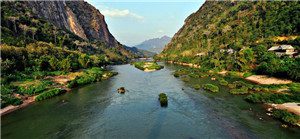
Jinghong – Chiang Saen (Thailand, 344 km, cruises 10 hours). The upper Mekong flows through Southern China, Burma and Laos and is now opened to foreigners. We join an express boat for the spectacular daytime journey to the Golden Triangle. We hope to land at a Laotian Aini Village. After our exhilarating boat ride we reach the Golden Triangle region between Burma, Laos and Thailand and disembark at Chiang Saen at 18:00.
–Mekong River:
The Mekong is a river in Southeast Asia. It is the world’s 10th-longest river and the 7th-longest in Asia. Its estimated length is 4,909 km (3,050 mi), and it drains an area of 795,000 km2 (307,000 sq mi), discharging 475 km3 of water annually. From the Tibetan Plateau this river runs through China’s Yunnan province, Burma, Laos, Thailand, Cambodia and Vietnam. Laos, Thailand, Cambodia and Vietnam established the Mekong River Commission in 1995 to assist in the management and coordinated use of the Mekong’s resources.
In 1996 China and Burma became “dialogue partners” of the MRC and the six countries now work together within a cooperative framework. The extreme seasonal variations in flow and the presence of rapids and waterfalls in this river have made navigation extremely difficult.
–Golden Triangle or Chiang Saen:
Chiang Saen, just south of the Golden Triangle tourist hell hole, is a quiet and very historic town that sits by the Mekong River and was once an independent kingdom. Archaeological finds in the area have placed development here in prehistoric times. More recent communities have been placed in the region of the 13th to 14th Centuries when one of the sons of King Mangrai, Saen Pu, on his father’s orders commenced construction of a walled city with the Mekong River being one of those borders.
Day10 – Chiang Saen – Chiang Rai
Activities: he Chedi Temple, Golden Triangle, the Opium Hall, Golden Triangle Archway,Chiang Rai City
Meals: Breakfast
Hotels: Chiang Rai
After breakfast visit Wat Pa Sak , about one kilometer to the west of Chiang Saen in Tambon Wiang, was built by King Saen Phu in 1295 and three hundred teak trees were planted, hence the name Pa Sak (Teak Woods). It was then the residence of the patriarch. The temple’s Chedi is of the beautiful Chiang Saen architectural style and the exteriors are elaborately decorated with designs. The Chedi Temple measures 12.5 meters tall with a base of 8 meters wide. Have buffer lunch in Imperial Golden Triangle Resort with the view. Have buffer lunch in Imperial Golden Triangle Resort with the view of Mekong.
Afternoon you will visit Opium Hall at the Golden Triangle Park, which is sponsored by the Empress Dowager. An Invitation to the Mysterious World of Opium From darkness to light, the 5,600 square-meter Hall of Opium presents the history of opium from its natural properties to its use as long ago as 5,000 years. Drive to Chiang Rai in the late afternoon.
–Mueang Chiang Rai
Chiang Rai is a city in Amphoe Mueang Chiang Rai, Changwat Chiang Rai, a northernmost Changwat in Thailand. Mountainous and alluring, Chiang Rai is one of the best spots to do trekking in Thailand. The provincial capital of the same name is home to a wide range of excellent accommodation, from five-star international hotels to cheap backpacker guesthouses, as well as some great eating spots, with most cuisines covered and swish Western/Thai style coffee houses boasting free WiFi starting to multiply. Chiang Rai also retains some of the small-town charm now relatively lacking in places like Chiang Mai and Bangkok, remaining the kind of place where a child might shout “Hello” from the back of their parents’ motorbike as they speed past. Chiang Rai has a charm which has disappeared from many of Thailands cities, such as Chiang Mai and most certainly, Bangkok.
Chiang Rai City is 200 kilometres northeast of Chiang Mai City, 62 kilometres south of Mae Sai and the Burmese border; 60 kilometres southwest of the town of Chiang Saen on the Mae Kong across from Laos; and 90 kilometres north of Payao town. The Mae Kok River runs along Chiang Rai’s north side, flowing from west out of Burma at Taton town – to east and thereby merging with the Mekong River. There are four bridges spanning the Mae Kok river within the town’s boundaries, each running south/north. Most of the terrain surrounding Chiang Rai town is either flat or has moderate hills. The exception is outward in the west and northwest directions, where limestone hills are evident, some of which have straight-up exposed cliffs. Not surprisingly, that’s also the direction where most of the region’s Hill Tribe people have their villages, further afield.
Day11 – Chiang Rai-Chiang Mai
Activities: Mekong River boat cruise,the hill tribe villages, Chiang Mai City
Meals: Breakfast
Hotels: Chiang Mai
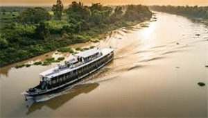
Depart Chiang Rai for Chiang Mai, a 5 hour boat journey up to Chiang Mai, stopping en-route at hill tribe villages in the jungle, with lunch at a local restaurant.
–Chiang Mai is the largest and most culturally significant city in northern Thailand, and is the capital of Chiang Mai Province. It is located 700 km (435 mi) north of Bangkok, among the highest mountains in the country. The city is on the Ping river, a major tributary of the Chao Phraya river.
In recent years, Chiang Mai has become an increasingly modern city and attracts approximately 1 million visitors each year. Chiang Ma gained prominence in the political sphere in May 2006, when the Chiang Mai Initiative was concluded here between the ASEAN nations and the “+3” countries (China, Japan, and South Korea). Chiang Mai’s historic importance derived from its strategic location on the Ping river and major trade routes. The city has long been a major center for handcrafted goods, umbrellas, jewelry (particularly silver) and woodcarving.
While officially the city (thesaban nakhon) of Chiang Mai only covers most parts of the Mueang Chiang Mai district with a population of 150,000, the urban sprawl of the city now extends into several neighboring districts. This Chiang Mai Metropolitan Area has a population of nearly one million people, more than half the total of Chiang Mai Province.The city is subdivided into four wards (khwaeng): Nakhon Ping, Srivijaya, Mengrai, and Kawila. The first three are on the west bank of the Ping River, and Kawila is located on the east bank. Nakhon Ping district comprises the north side of the city. Srivijaya, Mengrai, and Kawila consist of the west, south, and east respectively. The city center—within the city walls—is mostly with Srivijaya ward.
Day12 – Chiang Mai
Activities: the Elephant Camp, Wat Phra Singh,Wat Chedi Luang, Wat Chiang Man Temple, the Rukachati National Park
Meals: Breakfast
Hotels: Chiang Mai
Drive to the north of Chiang Mai to visit an elephants working site. Watch the elephants taking their daily bath in the stream before beginning to haul timber in the forest. Be amazed by their strength and intelligent team work. On the way back, we will visit the Rukachati National Park and its picturesque waterfalls, and lunch at a local restaurant.
In the afternoon, we will visit the most beautiful temples in Chiang Mai which include Wat Phra Singh with its famous Buddha image, Wat Chedi Luang, Wat Chiang Man, the oldest temple in Chiang Mai built by King Mangrai, Wat Suan Dok which houses the remains of many generations of the old Chiang Mai Royal Family and Wat Jet Yot. And the most beautiful of all, Wat Doi Suthep, tucked away in the mountains at 3,520 feet (1,056 meters). The temple is reached by a staircase with 290 steps, flanked by a NAGA balustrade on either side. The Monastery was built by King Gue-Na in 1383. The center is a big Chedi (spired pagoda) which contains partial relics of Lord Buddha.
–Maesa Elephant Camp
In the lush tropical jungle of Chiang Mai’s Maesa Valley , a big family of elephants lives side by side with their mahout caretakers. “Maesa Elephant Camp” is home to one of the largest assembly of elephants in the north of Thailand . Our philosophy is to create a natural and healthy environment for the elephants while working to conserve and breed them,due to the dwindling number of Asian elephants left in the wild.
Ripley’s Believe It Or Not (Thailand) awarded its coveted prize to Maesa Elephant Camp for its 2.40 metres wide and12 metres long painting entitled “Cold Wind, Swirling Mist, Charming Lanna ” and created by a group of eight elephant artists, as “the Largest Painting by A Group of Elephants” on December 13, 2004. The award was given to the camp on the day it staged the painting rehearsal for the Guinness World Records shooting that took place on February 19, 2005.
At the rehearsal, the eight elephants – Kongkum, Wanpen, Kamsan, Lankam, Duanpen, Songpun, Punpetch and Pu Ood – spent six hours creating the painting which combines eight panels each created by a different elephant. Only non-toxic acrylic was used in the painting and the elephants took a short break of 15 – 20 minutes every hour to have some food and water and take a rest.
Day13 – Chiang Mai – Bangkok
Activities: Bangkok City Tour
Meals: Breakfast
Hotels: Chiang Mai
Take the flight to Bangkok, meet your local guide and transfer to the hotel.
You will be free in the afternoon and explore Bangkok City by yourself.
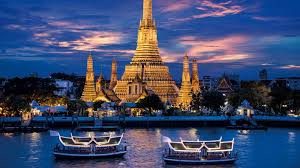
–Bangkok is the capital, largest urban area and primary city of Thailand. Known in Thai as Krung Thep Mahanakhon, it was a small trading post at the mouth of the Chao Phraya River during the Ayutthaya Kingdom. It came to the forefront of Siam when it was given the status as the capital city in 1768 after the burning of Ayutthaya. However, the current Rattanakosin Kingdom did not begin until 1782 when the capital was moved across the river by Rama I after the death of King Taksin. The Rattanakosin capital is now more formally called “Phra Nakhon” , pertaining to the ancient boundaries in the metropolis’ core and the name Bangkok now incorporates the urban build-up since the 18th century which has its own public administration and governor.
Aside of the sightseeing and shopping, Bangkok has developed into a magnet for food lovers of all origins. The same range of choice applies to the accommodation options all over town, from high end international chain hotels to family run guesthouses, demands of all travelers are met. In terms of wellness and relaxation – Bangkok has recently seen a huge development of city Spas and Wellness centers, in addition to the long established Thai massage centers.
Day14 – Bangkok
Activities: Royal Grand Palace Tour and Temple City Tour
Meals: Breakfast
Hotels: Bangkok
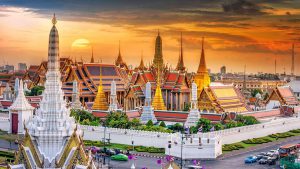
You will visit the Royal Grand Palace and have a Bangkok City Tour.
Depart from hotel to Rattanakosin Island, the original area of Bangkok when it was first established as the capital over 200 years ago.Visit Wat Trimit, known for its famous Golden Buddha. The beautiful image of solid gold is three metres high and weighs five and a half tons.
Continue the tour by passing through beautiful city scenery of the colorful flower market and Chinatown. The bustling business area of Chinatown is especially known for its gold jewellery shops. The atmosphere is totally changed at night – hordes of food stalls line the streets.
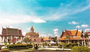
Visit Wat Pho or Temple of the Reclining Buddha, founded in the 16th century, the oldest and biggest temple with the largest number of pagodas (95 in all) in the city. Wat Pho was the first open university of Thailand which offered courses in several branches of knowledge like literature, astrology, medicine and massage. It’s well known for its huge Reclining Buddha, 46 m. long and 15 m. high.
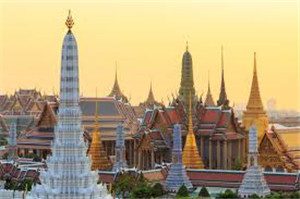
Visit The Grand Palace has an area of 218,400 sq. metres and is surrounded by walls built in 1782. The length of the four walls is 1,900 metres. Within these walls are situated government offices and the Chapel Royal of the Emerald Buddha besides the royal residences. Wat Phra Kaeo, the most beautiful and important Buddhist temple in Thailand. It is so richly and intricately decorated that, once entering the temple, you will feel as if you are in a real “city of angels”.
City-sightseeing tour along Ratchadumnoen Rd.(The Royal’s Way). En route you can see many magnificent temples and architectural buildings, including the City Pillar Shrine, National Museum, Democracy Monument, Golden Mountain, Thai Boxing Stadium, Anantasamakhom Palace, Parliament House, Dusit Zoo and Chitlada Palace King’s Residence. At the end of tour will be visit the local product store. Then tranfer back to the hotel.
Day15 – Bangkok
Activities: Floating Market River Kwai Tour
Meals: Breakfast
Hotels: Bangkok
Your journey commences with a leisurely drive from Bangkok, passing through salt fields and rice paddies before embarking aboard your long tail speed-boat on your journey to the floating markets. The floating markets are a fascinating experience, a complete contrast to how we shop for food in the west, and are made up of Thai style canoes laden with colorful and succulent fruits, vegetables, sweets and meats – gently plying their way through the canal, selling as they go. It is one of most popular Thai sightseeing experiences and not to be missed. If you want to take a closer look your local Thai guide will help you organize a local boat ride through the markets (optional extra).
You will then board your coach for the journey west to Kanchanaburi, home to the River Kwai and it’s infamous bridge. The building of the bridge in 1943 was part of a wartime project to link existing Thai and Burmese railway lines to create a direct route from Bangkok, Thailand to Rangoon, Burma (now Myanmar) in an effort to support the Japanese occupation of Burma. Over 100,000 conscripted laborers and 12,000 prisoners of war died during the whole project.
Lunch will be taken at a local restaurant before visiting the bridge after visiting the JEATH war museum, which houses pictures and paintings from this period. Combining the two attractions unfortunately means there is not enough time to take a train ride, before your journey back to Bangkok and your hotel.
Floating Market River Kwai Tour in Bangkok City.
Day16 – Departure from Bangkok
Activities: Departure
Meals: No meal
Hotels
Free time at leisure until Transfer to the airport for returning.
Service ends.
Service Included:
- Admission fees for all of the sightseeing spots listed in the itinerary;
- Meals as listed in the itinerary;
- Hotels as listed in the itinerary;
- Private English-speaking tour guide;
- Private vehicle for transfers & sightseeing with skilled driver;
- Service charge & government taxes;
- Luggage transfers between airports and hotels;
- Domestic train tickets of soft sleeper.
Service Excluded:
- Any arrival and departure international airfares or train tickets;
- Chinese visa fees;
- Excess baggage charged by Airlines;
- Single room supplement;
- Tips to guides and drivers;
- Personal expenses and gratuities to service staff;
- Personal travel accident insurance;
- All optional programs.


